John Rock Trail/Cat Gap Loop Wayfinding Signage The Pisgah Conservancy, Brevard, North Carolina
Project Overview
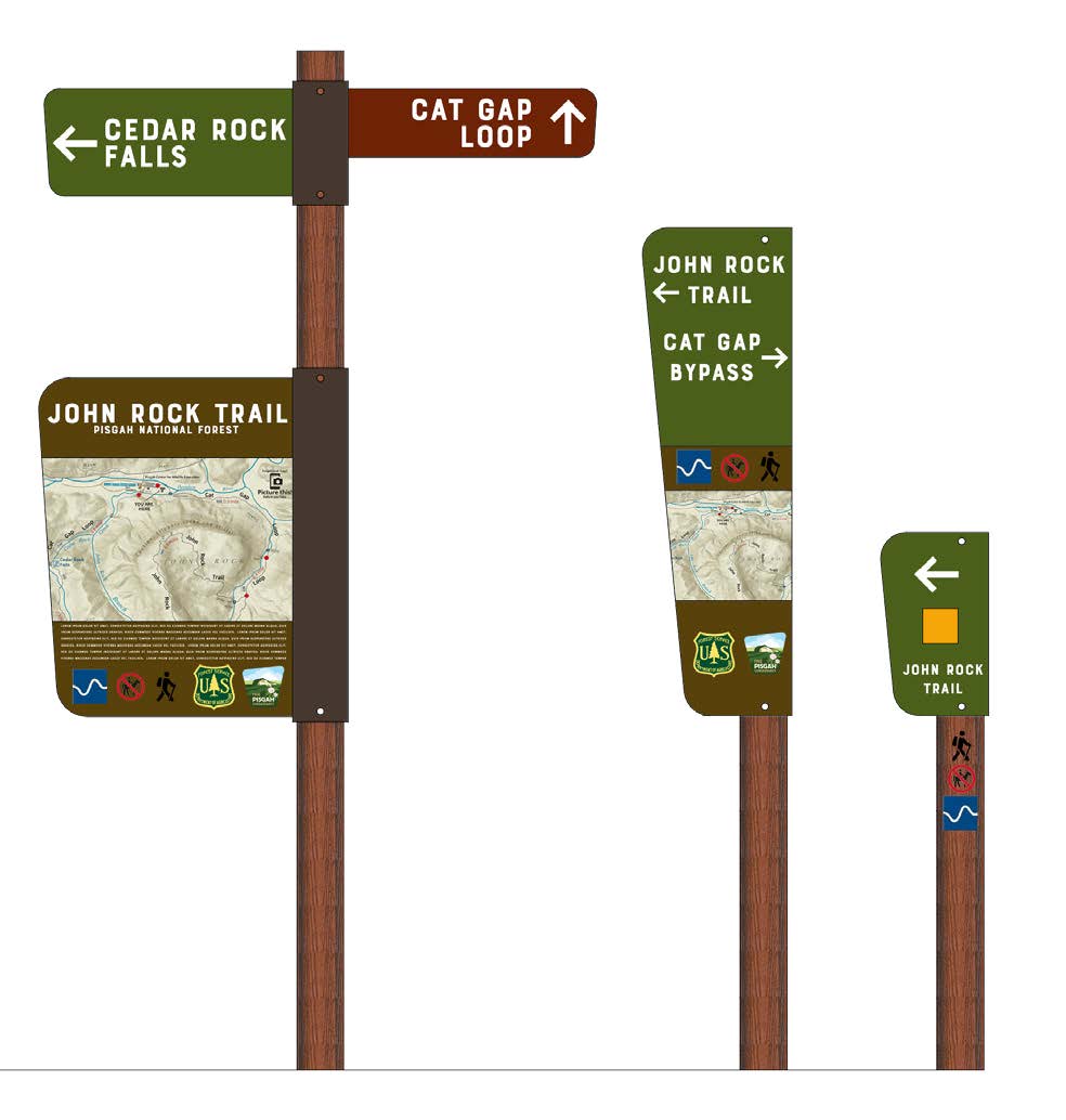
Studio Main led The Pisgah Conservancy through a comprehensive process to develop conceptual wayfinding signage for trail and mountain bike users, identify ideal placement to ensure safety, design gateway, directional, wayfinding, educational and kiosk signage, and provide construction documents for phased implementation. Each step of the process was collaborative with the United States Department of Agriculture, National Park Service, Pisgah National Forest, Pisgah Ranger District, and Cradle of Forestry.
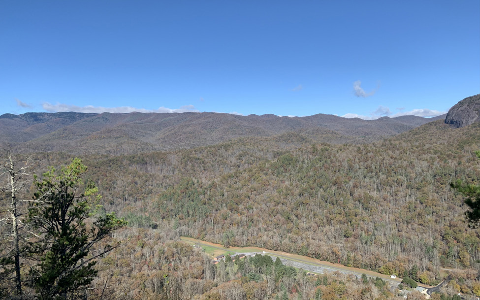
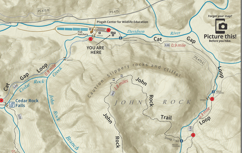
With a trailhead at Pisgah Center for Wildlife Education & Fish Hatchery, John Rock Trail Loop is a 5.7 mile moderately trafficked loop trail located near Brevard, North Carolina at the entrance to Pisgah National Forest that features beautiful wild flowers and is primarily used for hiking and backpacking from April through November. With multiple crossings with Butter Gap Trail and the Art Loeb Trail, the John Rock Trail and Cat Gap Loop was in need of directional signage to alert trail users of their location and distance to their destination. With over 400 miles of trails in Pisgah National Forest and over 500,000 acres, Studio Main, in conjunction with The Pisgah Conservancy, provided natural trail surface signage standards that can be implemented in phases throughout all trails.
Project Gallery

Our Unique Approach Driven By The People Who Make a Place Feel Like Home
We create active and thriving communities through our unique “Main Street Approach” and “Handlebar Perspective.” Our proven comprehensive landscape architecture and city planning process is both simple and comprehensive.
More On Our Process